For newcomers and visitors, the Delhi Metro route map can initially look like an intimidating, multi-coloured web blanketing the National Capital Region (NCR). However, the system is designed with a highly efficient logic. Every colour represents a dedicated corridor with a distinct route and purpose. Once you understand what each line signifies, navigating the massive network becomes easy.
The Purpose of Colour-Coding
The Delhi Metro Rail Corporation (DMRC) intentionally implemented a colour-coded system to ensure the transit network remains highly accessible. Commuters do not need to memorise complicated station sequences or numerical codes; they simply follow their specific colour from departure to arrival. This visual system effortlessly guides passengers across a vast network of stations spanning more than 374 kilometres.
Breakdown of the Delhi Metro Lines
Red Line
- Route: Rithala to Shaheed Sthal (New Bus Adda)
- Overview: The Red Line holds a special place in the city’s transit history as the very first operational corridor of the Delhi Metro. It spans 34.55 km across 29 stations, effectively linking West Delhi to East Delhi and reaching into Ghaziabad, Uttar Pradesh. Key transit hubs like Kashmere Gate allow passengers to seamlessly switch to the Yellow and Violet lines.
Yellow Line
- Route: Samaypur Badli to Millennium City Centre Gurugram
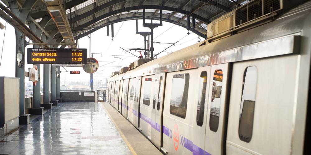
- Overview: Serving as the central anchor for commuters and tourists alike, this 49 km line features 37 stations. It cuts directly from North Delhi to the corporate hub of Gurugram, Haryana, passing through critical locations such as Chandni Chowk, New Delhi Railway Station, AIIMS, and the network’s busiest intersection, Rajiv Chowk.
Blue Line
- Route: Dwarka Sector 21 to Noida Electronic City | Yamuna Bank to Vaishali
- Overview: Operating as the network’s most extensive route, the Blue Line covers roughly 64.6 km across 59 stations. It splits into two branches at Yamuna Bank, acting as the primary transit artery for thousands of professionals travelling between West Delhi, Noida, and Ghaziabad.
Green Line
- Route: Kirti Nagar to Brigadier Hoshiyar Singh (Bahadurgarh)
- Overview: Spanning 28.79 km and serving 24 stations, the Green Line is vital for north-western and western suburban connectivity. It links Delhi to Bahadurgarh in Haryana, bringing rapid transit access to heavily populated neighbourhoods like Mundka, Nangloi, and Punjabi Bagh.
Violet Line
- Route: Kashmere Gate to Raja Nahar Singh (Ballabhgarh)
- Overview: This 46.6 km corridor runs through 34 stations, connecting the historic core of Old Delhi to the industrial hub of Faridabad. It is heavily frequented by passengers heading to major commercial markets like Lajpat Nagar, government offices around ITO, and prominent cultural hubs.
Pink Line
- Route: Yamuna Vihar to Maujpur-Babarpur | Maujpur-Babarpur-Shiv Vihar
- Overview: Marking a major infrastructure milestone under Phase 4, the final section of this corridor opened in March 2026, officially completing India’s first fully operational ring metro. Spanning 71.56 km across 46 stations, it forms a near-circular path around the capital. Because it intersects with almost every other major metro line, it allows commuters to travel across various zones of the city without adding to the congestion of the central stations.
Magenta Line
- Route: Krishna Park Extension to Botanical Garden | Majlis Park to Deepali Chowk
- Overview: Built to accommodate future passenger growth, the Magenta Line currently covers 50.18 km across 33 stations. It features advanced driverless train operations and provides a direct link to Terminal 1 of the Indira Gandhi International Airport. Following a newly inaugurated extension in March 2026, planned expansions will eventually push this line close to 89 km, positioning it to become the longest single corridor in the network.
Grey Line
- Route: Dwarka to Dhansa Bus Stand
- Overview: Though modest in scale at just 5.2 km and four stations, the Grey Line serves an important purpose. It functions as a specialised feeder route that integrates the outer, semi-urban localities of Najafgarh with the core metro network at the Dwarka Blue Line interchange.
Orange Line
- Route: New Delhi to Yashobhoomi Sector 25 (via IGI Airport)
- Overview: Tailored specifically for travellers, this premium 22.7 km line connects the central railway station directly to Terminals 2 and 3 of the international airport. Operating at speeds up to 120 km/h, the line offers a distinctively comfortable commuter experience, featuring onboard Wi-Fi and dedicated luggage spaces.
Rapid Metro – RMGL
- Route: Sector 55-56 to Phase-3
- Overview: A fully elevated metro system, RMGL spans 12.85 km across 11 stations covering Cyber City, Sikanderpur, phase-1 & more.
The Delhi Metro operates as a highly synchronised, multi-layered transit network. The Yellow Line runs north to south, the Blue Line spans east to west, and the Pink Line forms a near-complete ring around the city. At major interchange stations such as Rajiv Chowk, Kashmere Gate, Hauz Khas, and Botanical Garden, these corridors converge, allowing passengers to switch between lines and move seamlessly across the entire Delhi Metro route map.
From its humble beginnings as a short 8.4 km track in late 2002, the Delhi Metro all lines have now become one of the largest and most efficient rapid transit systems in the world. Recognising the unique path of each colour is the absolute best way to travel through India’s capital with ease.

