
The Grand Trunk (GT) Road, as the travel writer Brian Paul Bach poetically imagines in his book The Grand Trunk Road from the Front Seat, begins from the core of the great banyan tree in Shibpur Botanical Gardens in Kolkata. And I don’t totally disagree with this rather anachronistic thesis. Granted, there’s a small road running between the Banyan Avenue in the garden and GT Road South. But the road commissioned by Afghan Emperor Sher Shah Suri during his short reign of Northern India between 1540 and 1545 precedes the tree, a mere 250 years old, by at least another 150. But the tree and the road seem to share the same ethos. Its core trunk removed, the banyan tree grows, spreading its roots and shoots, furiously, in all directions, turning itself into a veritable tropical rainforest. The GT Road too seems to go on, despite its often dire state, forking out from and joining national highways, playing hide and seek with the main thoroughfare, going under the sand at Dehri-on-Sone and reappearing again at Sasaram.

Shibpur Botanical Gardens (Photo by mckaysavage)
This game of catching the elusive GT got rather exhausting after a while, and considering we didn’t have a month to cover the 4,200-km journey, we opted for a more sensible passage. As Denis, who piloted our car, a widely travelled Bolero, and was expectedly more concerned about the safety of the vehicle than ours, kept saying in a veiled attempt to push us towards the more practical Kona Expressway, “I tell you baba, there is no such thing as GT Road beyond Rasulpur level crossing [113 km from Kolkata] any more. It’s over.” But the Grand Trunk Road is not totally an abstract idea or a myth apotheosised in history as Denis would have us believe. It’s quite alive, in fact. Although this sign of life is often registered at the expense of the harried traveller, made to go through a series of bump-and-grind routines, it’s a terrain worth doing.
A journey across GT Road’s Indian leg from Kolkata to the Punjab– Pakistan border and back is like travelling in a time machine, as images of India – of its mythical past and forgotten antiquities and also that of the postreforms glitter, kitsch and deprivation – flash past, sometimes all at once. At the outset, it’s a pleasant drive on Strand Road along the Ganga, up the Vidyasagar Setu and through the dock area, replete with colonial charm. But as soon as one hits Howrah (GT Road South), a congested narrow, slightly winding and uneven road, the houses and shops on either side threaten to fall over and submerge the vehicle. This gets slightly better as one passes through Bali, Srirampur and Belur – the seats of higher learning, philosophical discourse and spiritualism – as the river (known here as Hooghly), swelling with heavy rains, shows up on the right, intermittently, between buildings.

Hoogly Bridge (Photo by Os Rúpias)
Past the factory shades and defunct chimneys from Howrah to Chuchura (once Bengal’s most productive industrial segment), one suddenly stumbles on the derelict wooden chariot at Mahesh, parked by the roadside. Post Mogra, greenery takes over. Sprawling rice fields, dotted by thatched cottages, barns and primordial contraptions to water the fields appear. Obscenely opulent mansions break the verdant monotony, jarringly. Nowhere else along the route does one find so many women working in the fields, specks of colour against a vivid green backdrop. AIR towers rise like futuristic pyramids. The Indian tricolour fluttering gaily on a speeding Maruti Swift beside us wilts, as a herd of buffaloes cross the road, sauntering. India halts for a moment before speeding up.
On the outskirts of Panagarh, an air force base, discarded military vehicles are dumped by the wayside, weeds growing through their rusty windows. The most picturesque segment of the journey is through Jharkhand, immediately after the smoke-spewing colliery area in Bengal. Although in places, the arrows on the asphalt, melting under the strong sun, have solidified back in crooked shapes, this is probably the smoothest drive on the route. A ride through this gently undulating road, whose rhythmic rise and fall is contrapuntal to that of the hills on either side, feels like being carried on the wings of a symphony. The approach to Topchachi, a picturesque lake surrounded by verdant hills, where the itinerant Bengali would go during vacations to stock up on fresh air, is a picture of dereliction.
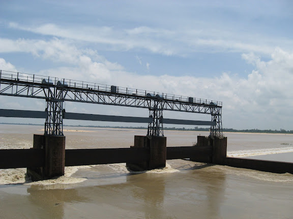
Panagarh (Photo by Amit Roy)
Varanasi onwards the sheer variety of vehicles plying across the Indian countryside and the ingeniousness in putting some of these together are in evidence. Fix a small generator set to a cart, add a wheel and a brake and you have your own cottage industry of vehicles sturdy enough to carry cattle rather than be pulled by it. The most spectacular of these are the mobile DJ bands – well covered autorickshaws with loudspeakers sprouting all over the iron frame, dressed up in harlequin colours.
As one passes through Allahabad, the transition in the local milieu is clearly demarcated. Prayag is plebeian/ spiritual, the area around Anand Bhavan is posh/ cultural and the cantonment area is a flawlessly sanitised domain of the defence personnel. As if in deference to the rule of law, dharam kantas, the bridges used to weigh loaded trucks, proliferate once we are in Uttar Pradesh (UP). In terms of numbers, it’s a neck-and-neck race with the ‘sarkari Angrezi sharaab ki dukaan’. One and two storeyed tenements, with windowless rooms and unplastered walls, appear on either side. SUVs used to ferry passengers between local destinations move with their doors open, people, goats, cycles and merchandise hanging out precariously, threatening to spill all over the road any moment. It’s interesting to watch how habits and cultures change subtly along the way. For example, the kiln towers, cylindrical in Bengal, are more faceted in UP, a simpler version of the Aztec pyramid. Women wear light cotton handloom in matted colour in Bengal but Bihar onwards give in to the lure of bright fuchsia. Palates change too. In Kanpur, we discovered GT Road parting ways with NH2, taking its own course, via Kannauj, Aligarh and Ghaziabad to Delhi. Not wanting to miss Agra – the town where Mughal Emperor Akbar built an impregnable fortress where his grandson Shah Jahan would later be imprisoned by the latter’s son Aurangzeb – and Mathura – replete with mythological associations around the young Lord Krishna – we followed the NH2 into Delhi.

NH 2 (Photo by Jigmi)
The plethora of massive real estate development and profusion of colossal shopping complexes in a radius of about 10 km beyond the outer circumference of the Indian capital is awe-inspiring, especially when juxtaposed against the images of squalor on, say, Ring Road. The smell of prosperity and big money continues in Haryana. Panipat looks like a model of urban development as one skims across on the flyover. Small shops dealing in building materials in Bengal, Bihar and UP are replaced by big establishments run by property developers and realtors. Dhabas with thatched sheds make way for large, fancy restaurants and drive-in outlets of multinational fast food chains, with expensive imported cars parked on the side. Between Phagwara and Kartarpur, luxury resorts, designed after medieval manors and fortresses, brush past in quick succession. And then the iconic green fields of Punjab show up, reflected in the accumulated floodwaters.
Sikh shrines begin to raise their heads against a background of parrot green and sky the colour of lead, as horses trot by. The stretch of the Grand Trunk Road crawling towards Attari, from opposite Lahori Gate in Amritsar, turns out to be practically unnavigable, so we turn back and continue on NH1. A cool breeze riffles through never-ending green fields of maize, punctuated by high-tension electric towers. Turbaned Sikh gentlemen walk past, flowing robes pasted against their erect frames, swept by the wind. Buffaloes graze or sit idly, chewing the cud. Children in blue turbans cycle back from school, swarming in on our car, casually.
Attari, the last village on this side of the Indo-Pak border, and Wagah, which marks the frontier, are a study in contrasts. While the former is a sleepy nondescript village almost oblivious to the historical value of the crumbling residence of its brave son, Sham Singh Attari, Maharaja Ranjit Singh’s favourite lieutenant, Wagah, where soldiers of the Indian and Pakistani armed forces conduct the parade of retreat jointly, is the scene of a carnival. Determined to follow in the footsteps of Sher Shah Suri, who laid a road from Bengal to Peshawar that served as a major trading route within India and beyond for more than 400 years, we decided to check out the Delhi-Kanpur segment by GT Road during the return journey.

Fields in Amritsar (Photo by jHat)
Frogleaping all through this stretch, often no better than an unmetalled country lane, cost us two days, endless tension and a bad back, but gave us Kannauj in the bargain. And it was here that we again met the formidable Sher Shah – the man who had seized and dismantled a gorgeous town King Harshavardhan built in the 7th century CE, one that explorer and writer Hieun Tsang said would take at least 150 years to build again, if it were demolished. The hand that built a road, evidently, was keen to put a mark on anything that came in the way.
ON THE ROAD
Surprise! Surprise! For a passage that is over 400 years old, the GT Road is actually, mostly navigable. It’s uneven only in those stretches where human habitation has grown around it and perfectly spic and span where elevated expressways/ flyovers bypass these towns and cities. As part of the Golden Quadrilateral project, linking the four metros of Delhi, Mumbai, Chennai and Kolkata, repair, reconstruction and broadening of the GT Road where it merges with NH2 is happening at a decent pace. And although the situation is pretty chaotic in certain parts, like Panagarh, take heart folks, this could only get better.
NH1, which runs from Delhi to Wagah, is more or less a smooth passage, except when it runs through cities or towns undergoing hectic urban development, as in Ludhiana. That’s where the traffic is really chaotic. The flyover on Panipat is so wide and smooth it’s almost like flying. Hotels and fancy resorts just outside big towns like Ludhiana and Amritsar get steadily bigger and more opulent along the way. Drive-through restaurants belonging to big multinational chains have limousines parked outside. But the part between Amritsar and Attari, once again, is shorn of the smell of big money. Bad roads are back, encroached on by shops, markets and one-storeyed tenements.

GT road (Photo by ramkrsna)
GT Road has ceased to be Kolkata’s conduit to North India as it was even around 30 years back. It’s now used for local traffic. The absence of heavy vehicles makes it less accident-prone than it used to be, although it’s not uncommon to see an upturned truck or two along the way. We didn’t get held up or delayed because of a traffic jam anywhere in the 4,200-km distance, except towards the journey’s end, when we had to negotiate a six-day-old roadblock put up by political activists on Durgapur Expressway, diverting most trucks towards good old GT. So if you would like to exchange dhabas and petrol pumps for great scenic beauty, GT’s the road for you in the West Bengal leg. And if you want to see how rural India travels, up, close, at the expense of sometimes clocking no more than 15 km an hour and risking grievous injury, the 448.5-km Delhi-Kannauj stretch of GT is your ticket to adventure on the surface of the moon.
Scant respect for road safety norms is evident in the Durgapur-Asansol section. Trailers carrying oversized beams and iron rods have a sad chappal hung from their end rather than the customary piece of red cloth. Upturned trucks take a while to be pulled up, holding up heavy vehicles, in the absence of highway patrolling. Cars without number plates, or with coloured number plates, ply merrily. Pumps selling high-speed diesel are few and far between, until one gets to Haryana and Punjab. About 1 to 2 km around the entry and exit points in each town or city – Mughalsarai and Kanpur for example – there’s usually a line-up of trucks and repair shops and filling stations, turning the road into a dirty, congested cesspool. Driving through this can be tough, extremely slow and tiring.

Jharkhand roads (Photo by Biswarup Ganguly)
Getting into the heart of Delhi from its periphery is a nightmare, given the rush of construction work for flyovers and the metro rail resulting in too many diversions and relentless traffic jams. Most cities in North India have no street lights coming on after dark, so try reaching your destination before sundown. Signposts indicating distances to different cities, directions to nearby towns, villages and tourist attractions, petrol pumps and eateries are rarely there in West Bengal, few and far between in Jharkhand and Bihar and more or less adequate in UP, Haryana and Punjab. There seems to be no dearth of petrol pumps along GT Road, except perhaps in the very beauteous parts of Jharkhand and Bihar. Since these are extremely desolate stretches, it makes sense to keep an eye on the fuel reserve indicator. Also run a check before going up on never-ending flyovers like the ones in Panipat and Kanpur. While driving in the 4-lane, pumps are less frequent on one’s left during the onward journey, but there are ample cuts in the median to the right side, so it’s not much of a problem. It makes sense to tank up on the highway outside towns/ cities, so as to not waste time in overcrowded petrol pumps. All the service stations mentioned in the distance chart are authorised by reputed automobile manufacturers. These are clustered around the entry and exit points of each town/ city.
Smaller, unauthorised service shops in the urban areas and around dhabas would be able to fix minor problems, and even supply spares to get by in times of crisis. Dhabas are few and far between in West Bengal, non-existent in the forested stretches of Jharkhand, adequate in Bihar, and a dime a dozen UP onwards.
Trip Facts
When to go: This drive is best done in winter as at any other time of the year the plains can be very hot. Yet, there’s no season like the monsoon to be able to appreciate the thick vegetation, the swelling fields of paddy, the canals, rivers and tanks spread out against an ashen sky. But travel in winter if you want to play it safe.
Driving tips: Drive with great caution to prevent the car from skidding and stopping when there’s heavy rain. It’s best to avoid damaged and potholed stretches, as these would only get worse. In the cow belt, it’s common for people to cross the highway with their herd of cattle, or a stray goat or cow to come suddenly trotting across the middle of the road. Be extremely careful not to hit either man or animal. It’s sure to ruin your trip. Ideally, one should take a sturdy AC sports utility vehicle as the terrain is rather rough in parts and the journey long and arduous. But a 4WD is not necessary. Even an Ambassador in good condition is sufficient for the drive, but lighter or small cars may not be such a good idea. Try not to stop or drive late when you are passing through the forested stretches in Jharkhand, or around Lake Topchachi. You might get accosted by undesirable elements.

Kolkata (Photo by seaview99)
Pit stops: While it’s mandatory to have restrooms in petrol pumps, these get steadily dirtier as one passes through Bengal, Jharkhand, Bihar and UP, and slightly better off again in Punjab. It’s preferable to go behind the bush if you feel the loo might give you an infection.
STD codes: Amritsar 0183, Delhi 011, Kolkata 033, Varanasi 0542
About the author:
Chitralekha Bhasu is a Kolkata based freelance writer who contributes to The Independent and The Times Literary Supplement in the UK. Her travel wishlist includes the trans-Siberian railway and a six country boat trip down to the Mekong River.

