
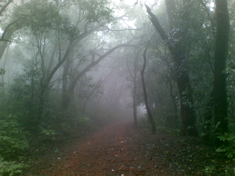
More than 500 million years ago, violent volcanic eruptions created a pile up of layers of volcanic lava. Centuries of weathering and erosion followed. And the Western Ghats, a range of hills along the Arabian Sea coast, took their present form. The part of these hills which lies in Maharashtra is given the name Sahyadri. The Sahyadri Hills may not be very lofty but for walkers their terrain is beautiful, rugged and challenging. Here you can trek, hike or just amble around a jungle, or combine it all with exploring ancient rock-cut caves or medieval forts, rock climbing, bird watching, fishing…. In no other part of India (or the world, for that matter) are there as many forts, from simple lookout posts and walled hillocks to imposing strongholds, as you will encounter in the Sahyadris. They usually guarded a major settlement, strategic pass or important trade route. Today, many are in a state of decay. Trains, local and long-distance, get you to the foothills of the Sahyadri in a couple of hours from Mumbai. State Transport buses, though slow and crowded, get you into remote areas. If you have your own vehicle, you can drive wherever you want but leave your vehicle in the care of a local or the village head and not by the side of the road. November to March is the best dry season for trekking or climbing in the Sahyadri. The weather is ideal, the skies clear and the vegetation green and rich. The monsoon is a fantastic time to be in these hills if you don’t mind being wet. This is when the Sahyadri take on a different avatar — gushing streams, raging waterfalls, lush fields and clouds of mist.
ASANGAON-MAHULI FORT
Mahuli Fort
[Distance 15-16 km, Time-6 to 7 hours, Mumbai to Asangaon, it’s 91 km/2 hrs by car, 21/2 hrs by local train]
A walk up to Mahuli (2,515 ft), located near Kasara, north-east of Mumbai, in the monsoon is the perfect way to return to nature — it is very picturesque and enjoyable, especially in the rains. From Asangaon Station, walk along the railway tracks towards Kasara (due north) for about half a kilometre till you come to a bridge over the tracks. Turn left and walk onto the road, heading west for 300m, and from here take the tarred road branching off right to Mahuli village. From Mahuli village, the tarred road runs west to the base of the fort. Cross the river (via a bridge) and you’ll reach the temples at the base of the fort. One can camp at these temples or even at the Hanuman Mandir just across the bridge. There is a well just across the bridge on the left that has good drinking water. From the temples, a well-used trail leads off into the forest, past two streams and climbs up a spur. This is the trail to Mahuli Fort and this is where the climb begins. The trail climbs steeply up the spur (due north) and then tops out onto a flat stretch (30 mins). The path then goes right for a couple of hundred metres and then turns left, going up steeply. An hour or more of uphill climbing brings you to an iron ladder that leads into the fort. The trail is well marked with white arrows painted on rocks and boulders. There is very little in the fort to indicate that it once served as an impressive bastion. From the western edge of the fort, you can get an excellent view of Tansa Lake, one of the major sources of water for Mumbai. To return, go down the same way you took to come up.
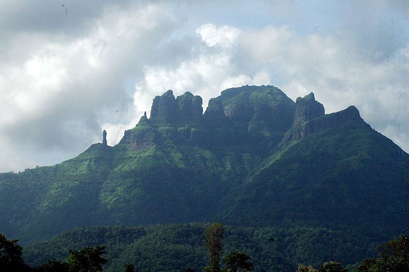
BARI-KALSUBAI

Kalsubai
[Distance 10 km, Time-5 to 6 hours. From Igatpuri, Bari is 40 km/11/2 hrs by car, 2 hrs by bus Mount Kalsubai (5,432 ft), near Igatpuri and near the border between Nashik and Ahmadnagar districts, is the highest peak in Maharashtra]
Highest, though, doesn’t mean toughest. Kalsubai is a trek for anyone who is reasonably fit. A breathtaking vista of shimmering waters and splendid forts awaits you, and making the trek even more exciting are the iron ladders that lead you up precarious paths and a series of pinnacles. From behind the bus stop in Bari, a footpath heads west across a field and joins a dirt road leading into Bari village proper. Follow this for a kilometre. Then a path cuts across a stream and some rice paddies and climbs up a spur to disappear into the forest. Initially, the climb is steep, then in 30 mins levels out onto a flat stretch with a few huts, open fields and a temple. Walk on behind the temple and climb up westwards to another flat stretch. You’ll encounter some thick lantana bushes before climbing up a spur (30 mins). There are iron ladders fixed at two points and a couple of railings where the path is a little precarious. The second ladder is steep and leads up a rocky gully. From here, the trail is very dusty with lots of scree. Kalsubai’s trademark is a series of false summits. Huffing and puffing to the top of the ridge, you are crestfallen to find that this is not the summit! About half a kilometre from the top is a small well. From the well, the summit rock is visible and a clear path leads up to an iron ladder that eventually brings you to the top. The view — lakes, hills and forest — is the icing on the cake. For the more adventurous, there is an iron chain on the left of the ladder, up to a small Devi Kalsubai temple. On the return, descend the way you came up but be careful as the scree makes the path rather slippery.
NARAYANPUR-PURANDAR FORT

Purandar Fort
[Narayanpur Village-Narayanpur Peth- Purandar. Fort Distance: 5 to 6 km, Time: 2 to 3 hours, From Pune, Narayanpur is 30 km/1 hr by car, 11/2 hrs by bus]
Purandar Fort (4,587 ft), well-preserved, clean and with an impressive past is up on a hill in the Bhuleshwar Range of Pune District. Begin at Narayanpur village with a visit to the ancient Mahadev Temple, an important place of pilgrimage. From there, it’s about 2 km along a tarred road to Narayan peth at the base of the fort. A path climbs a gentle spur due south-west with the fort walls clearly visible on your right. The trail will come out onto a road going up. Follow this for 100m till a hairpin bend from where the trail goes off into the jungle due east. From here, the entrance to the fort, as well as an old church are visible. The entire structure is in excellent condition — there are garrisons, barracks, resident quarters and bungalows. Beyond the church, and a small tea stall, a path goes to the top of the fort. From the top of the fort, one gets a grand view of the hills surrounding the city of Pune. The easiest way to return is to descend the way you came up.
MAHABALESHWAR-PRATAPGAD

Mahabaleshwar
Mahabaleshwar is surrounded by forests and hill forts — a great base for lovely treks. The trek to Pratapgad Fort is particularly enticing.
Day One:
[Mahabaleshwar-Zolai Khind Pass- Dudhgaon-Chaturbet-Ghonaspur- Makarandgad, Distance-12 to 15 km, Time-6 to 7 hours. From Mahabaleshwar, catch a bus or jeep going to Tapola and get off at Zolai Khind Pass. From the end of the pass, follow a trail on the right. Enter a dense forest and descend along a long spur to the Dudhgaon village (2-21/2hrs).]
Makarandgad Fort stands tall due south-west, surrounded by thick forest. If you’d like a shorter option, there are a few direct buses to Dudhgaon, but that would mean missing out on the lovely forests after Zolai Khind. From Dudhgaon, follow the dirt road due west, crossing the Koyna River before reaching Chaturbet. A footpath leads across fields and then up the hillside to disappear into the forest. The trail runs due south-west for 2-21/2 hrs before coming to a flat stretch, where it joins another trail coming from the left, from Dabhe village next to the Koyna Lake. From the junction, walk another 30- 45 mins, often through forest, due southwest to Ghonaspur village. The trail to the Makarandgad Fort goes west and climbs another 30-45 mins. There is a Mahadev Temple, where one can camp. Hire a guide from Chaturbet if you are not sure of finding your way through the forest to Makarandgad
Day Two:
[Makarandgad-Hatlot-Shirpoli-Koyna River-Pratapgad, Distance-10 to 11 km, Time-4 to 5 hours.]
From the Makarandgad Fort, descend to the west. In about 30 mins, you will come to a small temple set amidst some thick forests. Follow a trail from here going south-west, that leads down to Hatlot (1-11/2 hrs), a settlement comprising four hamlets. Just past the last of the four hamlets, the trail turns due north-west and follows a dirt road (1 hr) to the Koyna River and then to Dudhgaon. Take a left, past Shirpoli and Dudhgaon Phata. Cross Parpar village (30-45 mins) and then Sondpar village, from where a path leads up a gentle spur, due west to Afzal Khan’s Tomb (1 hr). From here, follow the tarred road that will get you to the base of the Pratapgad Fort (3,564 ft) in 10 mins. As you enter the fort you will come across the watchtower and its protective walls. Further up there is the Bhavani Mata Temple. There is also an exquisite quartz Shivaling. Also, you can’t miss the huge bronze statue of the famous Maratha chief. You can spend the night in the fort or catch a bus or jeep to Mahabaleshwar.
KARJAT-MATHERAN
Matheran
This is a popular trek during the monsoon. You can trek to Matheran via either Rambagh Point or Ambewadi village.
About the author
Kasturi loves to escape into the wilderness every now and then and when she is away, music is her only companion. You can contact her at [email protected]

