Time 6-8 days
Ideal Season Mid-Jun to late Sep
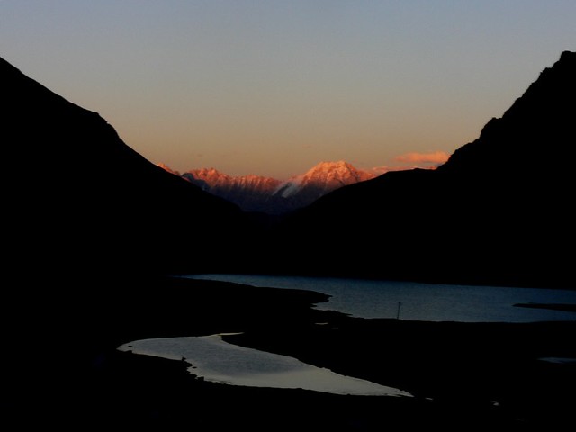
Location South-west of Leh, between the Stok and Zanskar ranges
Level Moderate to Tough
With every second shop in the Leh Bazaar being a trekking agency offering the Markha Valley Trek alongwith the less strenuous jeep journeys into Nubra or Pangong, you may be forgiven for thinking this is a breeze. It is not. At Markha, a Swiss couple stumbled into my campsite begging for food and the use of my ponies to carry their overweight backpacks. Just before dinner at Tsigu, I was roused from my tent by a terrific commotion from the English camp.
Turned out that the travel agent who had offered them such a great deal didn’t feel obliged to provide full rations, and all they had left was flour and onions with two hard trekking days still to go. Needless to say, I was obliged to rescue everybody. Still, I would recommend this trek, particularly if you time it to avoid the peak tourist season, as it gets very crowded. And get yourself a guide at Leh. The trek itself is thrilling. It’s set in part in the beautiful Hemis National Park, with two 4,800- 5,000m high passes to cross. There are waist-deep rivers to ford too.

A Chukar Patrige at the Hemis National park (photo by Karunakar Rayker)
This trek satisfies the most demanding of adventurers. Add to that the pleasure of campsites set among aromatic shrubs and wild roses. You can spot bharal (blue sheep), nearly totally disguised on the bare mountains. Or chuckle at the antics of the phia (marmot) as you end up enjoying quite the perfect holiday.
DAY ONE
SPITUK-ZINGCHAN
TIME 4-6 HOURS
LEVEL MODERATE-EASY
The trek traditionally starts at the bridge over the Indus about a kilo- metre west of Spituk Village. How- ever, a jeepable road slated to connect Spituk runs nearly all the way to Zingchan and if you get your taxi to drop you 7 km down the road to the point opposite Phey Village, you can skip the 2-hr long hot walk over unchanging scree-filled landscape (particularly after the Spituk Pharka Village) From this point it is a fairly pleasant walk along the descending road in a south-westerly direction along the Indus on your right, until you arrive at a fork where a swift flowing stream joins the Indus from the left. Walk into the valley due south, across the bridge, which can be a pleasant resting point.
A walk of a couple more kilometres will bring you to a road sign: ‘Jhingchan to Rumbak Road 1.00 km’. Look out for the log bridge here — nothing more than a few poplars lashed together — which often gets washed away. If there is no bridge you will have to ford the thigh- deep stream. After crossing it, find the path heading south-east which climbs suddenly onto the hillside to Zingchan Village. There are two campsites here — one just before you climb up and one past the village down by the stream called the Daisy Campsite.

Spituk (Photo by Redtigerxyz)
I preferred to walk a little further for an hour, crossing the stream once more on a bridge, past a Forest Checkpoint with a sign welcoming you to Hemis National Park. Continue up the well- defined path, crossing the nullah at east four times before you arrive at Sumdzom, marked by a stone chor- ten with prayer flags and a grove of willows and wild roses. There are good camping options here. ◆Entry fee to Hemis National Park Rs 20 per person per day.
DAY TWO
ZINGCHAN-KANDALA BASE CAMP
TIME 5-6 HOURS
LEVEL MODERATE-TOUGH
From Sumdzom walk upstream on the left bank (true right bank), cross- ing the stream twice over sturdy wooden bridges. Then climb steadily up the hill as the path moves due south-east until it comes out of the narrow gorge. Straight in front is the Kandala Nallah, along which a path leads to high pastures. On your left, or east, is the path which leads up to Rumbak Village. And up ahead, crossing the nallah and to the right is the path leading to Nyurutse and the Kandala Base Camp.
This junction is a pretty spot with wild flowers and a tea shop, a perfect resting place. Follow the Nyurutse path as it climbs steadily southwards. Nyurutse is a tiny hamlet and you can rest here, but see if you can press on for another hour that will bring you to a parachute-tent tea shop (shops in tents that come up during the season). There are plenty of camping spots right after Nyurutse and even after the tea shop, but if you are a small group then head up south-west to the Kandala Base Camp for the night. This is a small flat piece of land with a water source. It commands very nice views of the valley below, besides cutting short the sharp climb up to the pass the next morning.
DAY THREE
KANDALA BASE CAMP-SKIU
TIME 7-8 HOURS
LEVEL TOUGH
Set out early, particularly if you have camped below the Kandala Base Camp 62 last night as today is a long day. The trek up to the Kandala Pass (4,870 m) takes a little under 2 hrs of steady climbing from the base camp. Follow the path south around the hill and then, instead of going straight up the pasture, find a path to the right or west which zigzags up to the pass marked by prayer flags. Look out for marmots en route. From the pass, a well-defined path leads down to Shingo. This is a surprisingly long descent on a well- defined path, taking around 2 hrs to the parachute tea shop.

Skiu (Skyu) [photo by Quentin Talon]
From Shingo, head south along the village wall and as you come out into open fields, look for a path to your left or east, which heads steadily downhill in a south-easterly direction through a narrow gorge filled with wild roses. The path to Skiu is very well defined except that you have to cross the Shingo Nallah at least four times. It’s a shallow stream except in one or two places and it’s pleasant to get one’s toes wet. From Shingo, it should take you no more than 3 hrs even if you factor in a longish lunch break. Skiu, situated in the Markha Valley, which runs west to east, is a fascinating place with ruins of ancient monasteries. There are two campsites here at Skiu. One, a small one as soon as you enter the village, and another more favoured one, just past the village by the Markha River. One can have a lovely rest day here, bathing at the river and doing a side trip westwards into the Zanskar Gorge to the small village of Kaya.
DAY FOUR
SKIU-MARKHA
TIME 6-7 HOURS
LEVEL MODERATE
If you have rested the day before, today will be relatively easy as you are walking on more or less level ground in the Markha Valley. From the second campsite, head a few hundred metres north to the edge of the pasture and find a broad path going east. After a few kilometres, you will come to a broken bridge across the river. Do not cross but continue walking upstream, heading east, into the thicket of willows and out. You will be walking either at the base of the hill or on a path cut into its side.

Lone Yak In Markha Valley (photo by Balachandran Chandrasekharan)
About 7 km from Skiu, the path climbs up and abruptly confronts a high, but sturdy wooden bridge across the Markha. From here, it is a couple of kilometres to Sara where one can stop for some hot tea and refreshments. Soon after, the path descends to another solid bridge crossing over to the true right of the valley into the village of Chalak. The path then climbs steadily eastwards up to a ridge which has some very weathered, large Mani walls, some painted red, replete with prayer flags and bharal horns. Descend to the valley floor, crossing a small, swift stream and continue eastwards on the true right of the valley for about an hour.
Then cross the cold, thigh-deep, swift Markha River. Ensure that your guide picks the shallowest spot and helps you cross to the true left of the valley. A couple of kilometres later the path descends to a bridge. There is a walled campsite here as well as across the bridge, closer to the Markha Village, fort and monastery. Spend the evening exploring these.
DAY FIVE
MARKHA-THUJUNGTSE-TSIGU
TIME 7-8 HOURS
LEVEL TOUGH
Today is a long day, particularly if you are camping at Tsigu. From the campsite, skirt the hill, past the primary school (no need to climb up the main path to the fort), cross the small stream and head east past the fields. After a few kilometres you will find a bridge across the river. Ignore this and continue on the path up the rise and down onto the river bed. The Markha River traces a wide ‘U’ so it needs to be crossed twice within a couple of hundred metres. The river is deep and swift, so ensure that you have help while crossing. Climb up the bank, past Mani walls, heading in a south-easterly direction, passing the Teja Gompa and climbing gently up to the tea-stall at Umlung.
From here, the clearly defined path continues in a south-easterly direction, first climbing a small rise and then dropping down to a large, flat plain with some fenced fields. The Kangyatse Peak (6,400m) dom- inates the landscape. Continue until you reach the small settlement of Lower Hankar. Beer is usually available here! From here the path runs downhill to the river and sharply veers to the left or north and leads up a very steep slope up to a ridge which has the remains of an old fort. From here the village and fields of Upper Hankar lie before you.
Follow the path down into the valley eastwards, until the path veers left or north into a narrow gorge, then east and upwards again to Thujungtse. If you are a large group, then it is better to camp here. If not and you aren’t entirely wiped out, then walk another hour for Tsigu that is located in a cirque with a couple of small tarns. The views from here are spec- tacular. Walk uphill, north-east through a braided stream, and right (east) around a hill. There is a path that moves up to your left.
On the way to Thujungste (photo by alin_dev)
Do not take that. Walk straight up (north), up the valley in front of you, keeping to the right of the valley until you come to a fork that moves right. Do not take this. Look to your left (west) instead and find a path zig-zagging steeply up to the top. On the ridge you will find the clearly defined path going northwards to the campsite, only 10 mins away.
DAY SIX
THUJUNGTSE-TSIGU-NYIMALING
TIME 11/2-3 HOURS
LEVEL EASY
Nyimaling is a beautiful, broad, grassy valley with plenty of drinking water. If you have stopped at Tsigu for the night, then you can do the side trip from Nyimaling to Kangyatse Base Camp on the same day. If you are walking from Thujungtse, it may be too tiring. Either way, you may want to factor in another rest day here. From Tsigu find the well-defined path heading east in a series of switch backs until you come down into the broad valley with a parachute-tent tea house marking the Nyimaling campsite.
SIDE TRIP TO KANGYATSE BASE CAMP
TIME 4-5 HOURS
From the Nyimaling campsite, take your guide and head due south, ascending gently over pasture land for a couple of hours until you reach the snow line, marking the base camp of the mountain. Pack a picnic lunch with a thermos of coffee. Head back the same way.
DAY SEVEN
NYIMALING-SHANG SUMDO
TIME 7-8 HOURS
LEVEL TOUGH
Across the stream to the north are a few homes, which make up the village of Nyimaling. Find the path that goes past them ascending steeply to the Kongmaru La at 5,130m, marked by prayer flags. It should take you 2-3 hrs to the top. From here the descent is sharp and treacherous and many pack animals have been lost because of care- lessness. A little over an hour should bring you to Lhartse, a small, but dusty campsite where you can take a break.
Hemis Monastery (photo by madpai)
From here, follow the path along the small stream. This flows into a narrow gorge where you must watch for rock fall. There are some places where the path disappears and you have to clamber over boulders. Do not be tempted to climb the shepherds’ paths on the true right of the gorge. Stick to the left as the gorge broadens and look out for a well-built paved path on the left that climbs the side of the gorge. Look out for bharal. Stop for chai at Chuskyurmo. Then continue north, past the picturesque vil- lage of Chokdo and on to Shang Sumdo where there are many campsites. For those in a hurry, a jeep- able road to Shang Sumdo means that you can actually be picked up here.
DAY EIGHT
SHANG SUMDO-HEMIS
TIME 3-4 HOURS
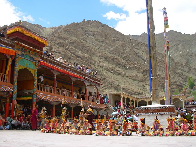
LEVEL EASY Spend the early morning exploring the side valley and the monastery of Shang. Then set out along the jeepable road to Martselang. Here, leave the main road, and head west on a path which goes over the scree slopes all the way to Hemis. However, this is a very hot and boring walk and I would get the taxi to meet me at Martselang, and drive up to the Hemis Monastery instead. After visiting the monastery in Hemis, which also has a dhaba where you can have some chowmein, continue on to Leh.
By Sonia Jabbar About the author: Snia Jabbar is a writer, journalist an a photographer. Writing, editing and photo-editing the Outlook guidebook for Trekking destinations in India, has been, for her, an act of thanksgiving to the Himalayasfor providing so much wonderand delight over the years.

